


Phone Vince on: 021 438 952
NZTA Submission 25th November 2010
Submission On the Upgrading of State Highway One Through Whangarei.
Application by NZTA
The application by NZTA in relation to the upgrading of the State Highway through Whangarei is very impressive. I congratulate the engineers, landscape architects, and designers that have all put extensive hours into the details of the project.
Even though my submission was in essence very small, the impact that it may have can be rather large and should not be overlooked.
In summary I oppose the proposed upgrade to State Highway One through Whangarei, and subsequently offer an alternative that has not been investigated by the designers. An alternative that better deals with the growth of Whangarei and the surrounding districts, as I have no evidence that the NZTA designers have taken this into account.
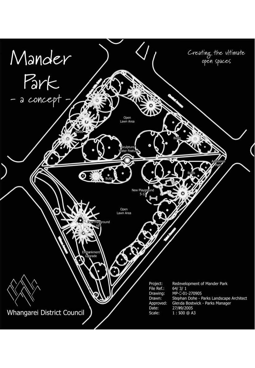
Figure 1 – Mander Park Concept design from WDC agenda October 2005
History of Mander Park. (Adapted from the WDC Agenda Oct 2005)
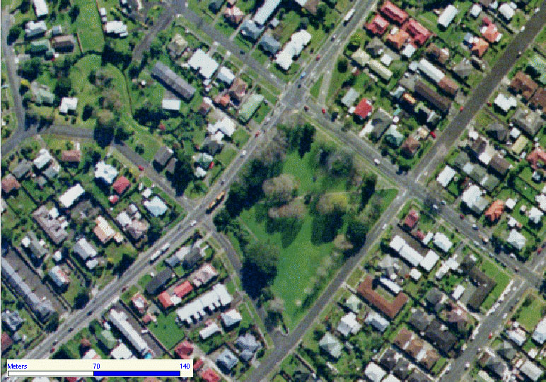
Figure 2 – Mander Park
Mander Park was the first park gifted to the people of Whangarei. It is located alongside State Highway One, and is surrounded by the avenues, with a stream on the southern side. The park contains 1.2 hectares of open lawn and large trees, which add a sense of maturity to the surrounding area. The heritage trees on its fringe include Ginkgo, Oak, Liquidambar, Tulip tree and Elm, as well as Totara, Puriri and Kowhai.
At the time it was given to the borough of Whangarei in 1906 the site had already been subdivided into 11 sections and is estimated to have been worth one hundred pounds. Today the value of the land, if it were zoned for residential use, would be over two million dollars.
Francis Mander
Mander Park was named after Francis Mander, the man who, on July 10, 1906, gifted the land to “the Mayor, Councillors and Burgesses (citizens) of the Borough of Whangarei”.
Francis Mander was born at Onehunga on December 1 in 1848, the fifth child of John and Mary Mander, who had come from Worcester, England, aboard the ship Ramillies the year before. He left school at 10, after only two years’ education to become a farm labourer and later tried his hand at prospecting in the goldfields of Thames. After working as an employee for ten years he bought his own land to break in as a dairy farm and soon after married 20 year old Janet Kerr.
Dairying did not provide sufficient income to support a young family, so he bought a mill and land with bush for milling. Over the years, with his old school friend and business partner, Samuel Bradley, he erected mills at Port Albert on the Kaipara Harbour, in the Waitakere ranges and also at Puhipuhi, near Whakapara. One of their legacies is the famous Nihotapu tram line, which their firm constructed over the Waitakere ranges.
When Mander’s eldest son took over the management of the mill at Puhipuhi, Francis Mander had time to pursue other interests. In 1902 he bought the Northern Advocate newspaper in Whangarei. The same year he contested the parliamentary elections and won the Marsden seat, which extended from Whangarei to Waiwera. During his 20 years in Parliament he was re-elected 5 times, each time with an increased majority.
Francis Mander retired from his parliamentary role and in March 1923 a garden fete was held in Whangarei in his honour. He then took up an appointment with the Legislative Council and continued in that role till he was 82.
Jane Mander
Jane Mander, Francis Mander’s eldest daughter, is famous as an early New Zealand novelist. She is remembered best for her novel, ‘The Story of a New Zealand River’, which is based on her experiences in the small rural communities on the Kaipara Harbour, where she grew up. In the same year as he gifted the park to the Borough of Whangarei, Francis Mander built a new house, called Pukenui Homestead, in Hatea Drive. It was known as the Tower House, because of the tower on top. The tower is now at the Whangarei Heritage Museum, where it is used to house Jane Mander’s study. When her father, Francis retired at 82 in 1931 Jane returned from studying at Columbia University to look after him, till he died in 1942.
Children’s Playground
The children’s playground, the original of which was also donated by an anonymous donor, who gave 25 pounds in 1925. There are a large number of parents and children in this neighbourhood, which all use the playground, and therefore has since had a new playground installed. Subsequently Teddy-bear picnics have been done in this park for the enjoyment of children and the parents in the area.
There is great history in Mander Park as can be seen above, and with the cutting down of these trees and shrinking the size of this park you will be taking away a large part of Whangarei and what has made Whangarei. Today NZTA and the WDC take 6 meters tomorrow NZTA and the WDC take 6 more meters, until 20 years go past and there is no Mander Park, well what is left is just a reminder of what was. Let us hold onto our heritage, so we can tell our children in the future.
Traffic Flow Designs
Central and Selywn Ave, along with the State Highway are classified as arterial roads. Arterial roads require high-end designs as they are designed to carry large volumes of traffic, with heavy loads. Arterials roads are not typically for dealing with pedestrians nor cyclists, there is examples around New Zealand where pedestrians and cyclists are on arterial routes these same routes also have high levels of accidents, and are hence not recommended as standard practice.
Within item 8.1 (page 15) from the Report to the Hearings Commissioner, dated November 2010, states that the State Highway presently carries approx. 22,000 to 26,000 vehicles per day with a projected growth of between 2 to 3% per year.
I have since taken those figures and extended them to the 20-year mark, as we know all good roading designs should have a design life of 30 years, as stated in NZTA manuals.
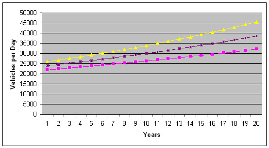
Table 1 – Vehicles per Day verse Years from Today.
As you can see by the above chart that over the next 20 years it is estimated that the traffic volumes along the State Highway will be in the vicinity of 32,000 to 45,000 vehicles per day, after 30 years these figures will be even larger.
Since no report had been provided to the submitters about the actual pavement design, one would presume that the standards should be adhered to. Due to the pavement movement around the intersections it would be estimated that the sub-grade CBD could be approx. 5 to 10, meaning that the pavement thickness could be in the range of 500 to 600mm deep, this would indicate that the pavement would need to be replaced on all of the road width. In discussions with the NZTA agent it was stated that the main reason that the design was left this way (with no horizontal shift), was because the designers did not want to move the centerline. This action is not in accordance with the best design practices, and therefore the Whangarei residences will be left with a sub-standard pavement again.
On page 208, within section 2.2 of the Transport review, it states that “The speed limit on Western Hills Drive through this section is 50 km/hr, and as with most urban arterial roads much of the traffic travels at slightly higher free speeds.” This increased speed is typically between 60 and 70 km/hr, as I live on the State Highway within town, I personally have clocked someone traveling past my house at those speeds, sometimes even higher.
Pavement widths and the number of lanes to be provided raise concerns, as within traffic design if you remove the visual barriers the driver tends to travel faster. The trees along Mander Park are traffic calming tools, and I would even go the next step and encourage NZTA to install more trees along the other side of the State highway, to help slow the traffic down. A method used regularly in Australia where arterial roads come into rural town ships.
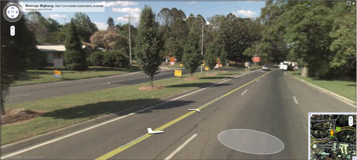
Figure 3 – New England Highway Toowoomba Queensland
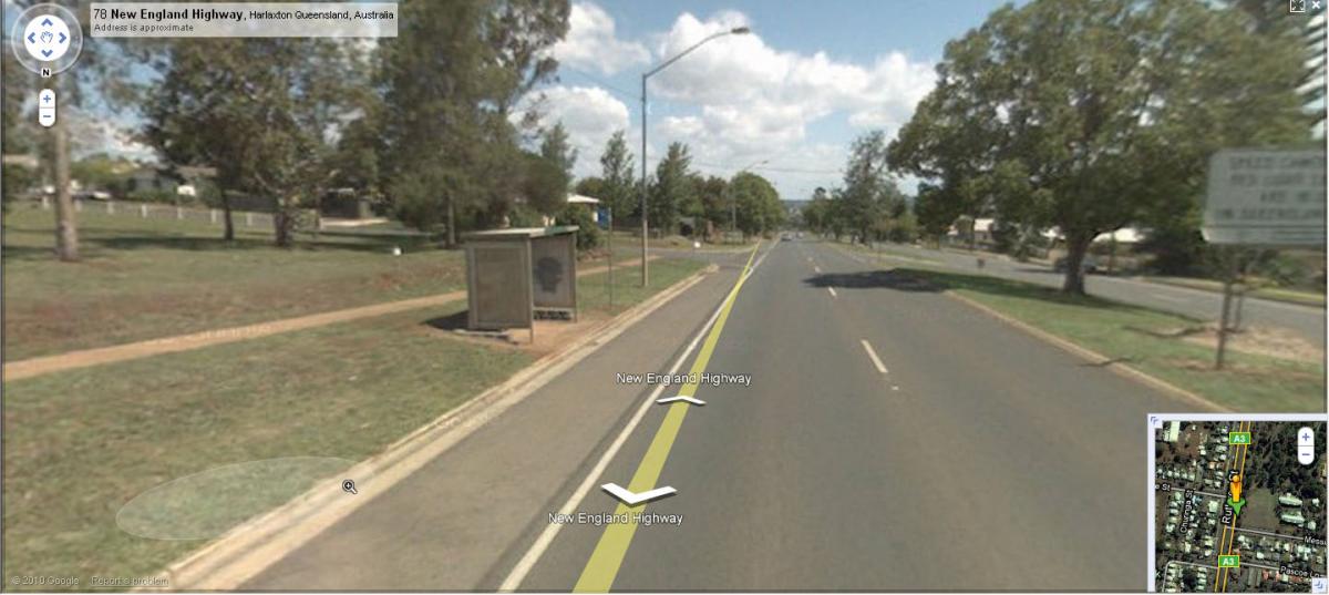
Figure 4 – Warrego Highway Toowoomba Queensland
Within Item 11.13 (page 41) of the hearings report the writer states “it is considered that the NZTA has reached a reasonable conclusion in terms of alternatives, warranting its support as the preferred alignment (chosen option).” This statement I do not agree with, and believe that NZTA is short-changing Whangarei. Trying to produce a second rate (low budget) job which should be unacceptable to any person of the Whangarei public.
Trees are traffic claming and they have a large effect on the traffic speed and flow within a city, instead of removing the trees from Mander Park, and cutting down the size of this park, it would be in my recommendation that additional trees are installed and the road is made wider on the other side of the road to create a gateway effect for driver to be part of the positive experience of traveling through Whangarei.
Intersection and Layout Design.
The way this project has been presented to the Whangarei public was disturbing. More traffic lights, closing off roads, removing trees and doing the cheapest option is the best. These solutions are far from the best way of putting projects together.
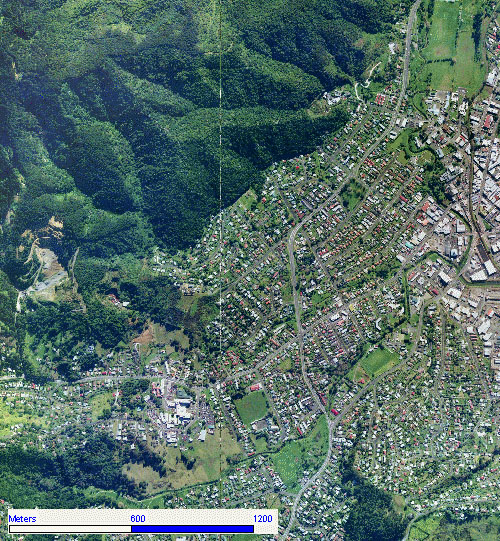
Figure 5 – State Highway One through Whangarei.
Admittedly Selwyn Ave to Wilson Ave is just a small section of the overall project, this small section actually affects how the rest of the residential networks interact with the State Highway.
With examples: The Wilson Ave entrance will be closed off to the State Highway, with an additional entrance made for the Wilson Ave residences off Central Ave through Fifth Ave. The Forth Ave entrance onto the State Highway will be closed off to certain traffic movements with the Cheviot Street entrance being the main access for the residence in this area. The Cheviot Street will have additional sets of traffic lights installed as this intersection is too close to the Maunu Road intersection and the traffic lights will then be connected. Additional traffic lights installed at the end of Tarewa Road and SH1, and Raumanga Valley Road and SH1.
As stated above the Intersections of Selwyn / SH1 and Central / SH1 along with SH1 / SH14 will be mayor intersections, as these are all arterial roads, therefore they should require a lot more design. Unfortunately NZTA is taking a shortcut and providing a stopgap method of additional traffic lights.
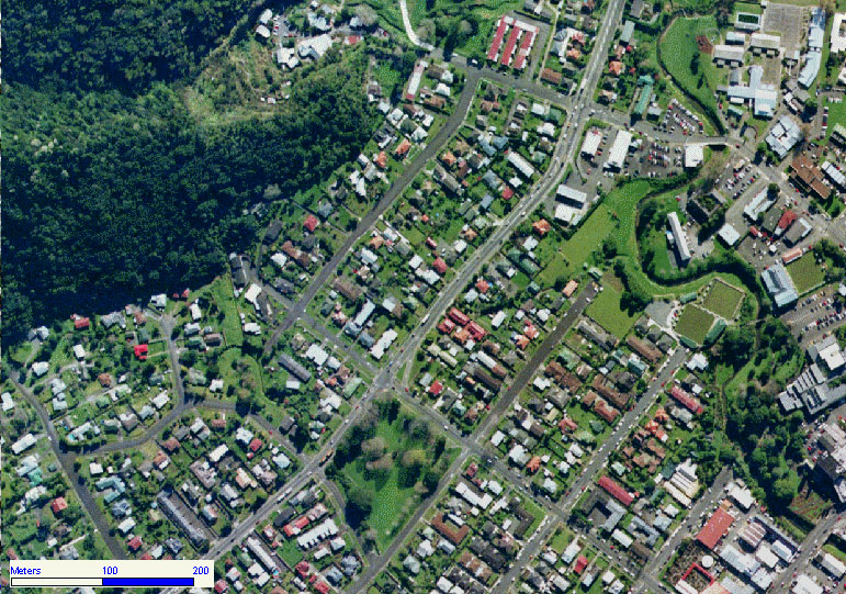
Figure 6 – State Highway One present layout.
With the traffic lights that are proposed within this development, yes there footprint is small and they do allow pedestrians to cross the road, but arterial traffic route are not made for pedestrians. There are alternatives that can be used for pedestrians. Such alternatives are; over bridges, special pedestrian walkways, and underpasses.
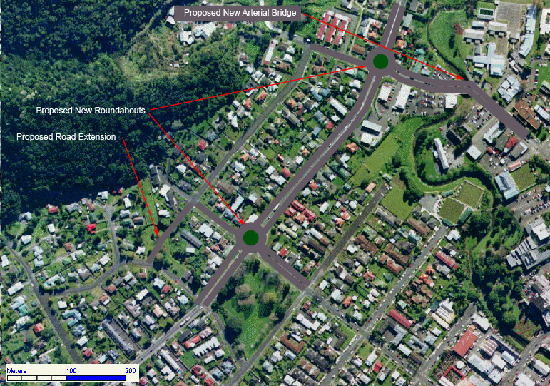
Figure 7 – State Highway One Proposed New Layout
Figure 7 (above) shows what can be done, for a very small amount of cost and this layout also provides for the future. We do not have a Greenfield (blank canvas) situation in Whangarei with the State Highway that travels through the center of the city. With roundabouts, you will be providing for the future, no more coming back to do fix-ups. Having large roundabouts like these above, allow for motels to be constructed along the highway, so that vehicles from both directions can access them.
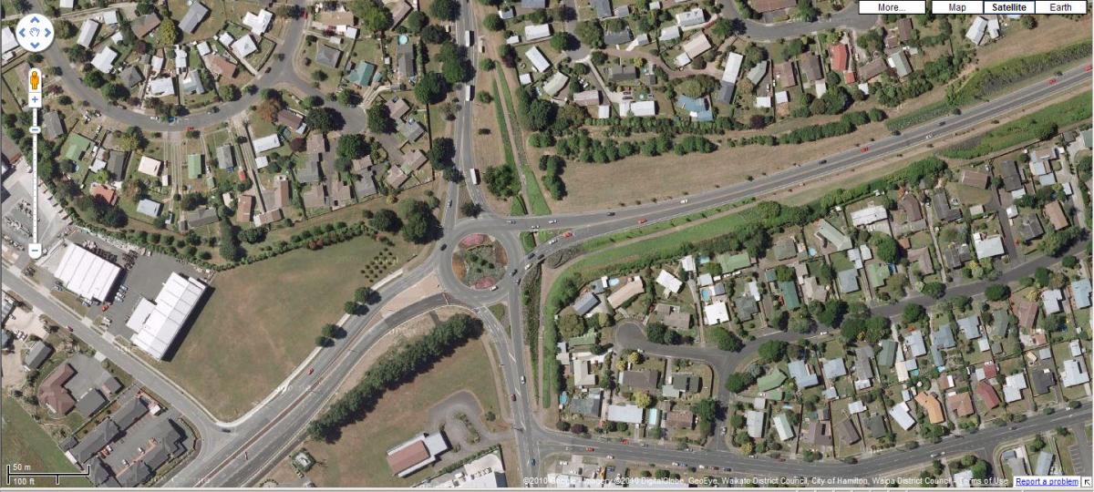
Figure 8 – State Highway One through Hamilton
The main point here is that Mander Park does not need to be touched, and that NZTA are looking at one option without exploring all other options.
Ascetics / Image
The following are images of Mander Park. The size and health of these trees indicate what they have been through in their lives. By letting NZTA hack these trees away, does nothing but reduce the ascetics of the city, it reduces our history and reduces our future, so that we become more like Auckland, where there are few trees and only concrete.
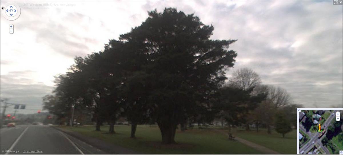
Figure 9 – Mander Park Looking North from State Highway One.
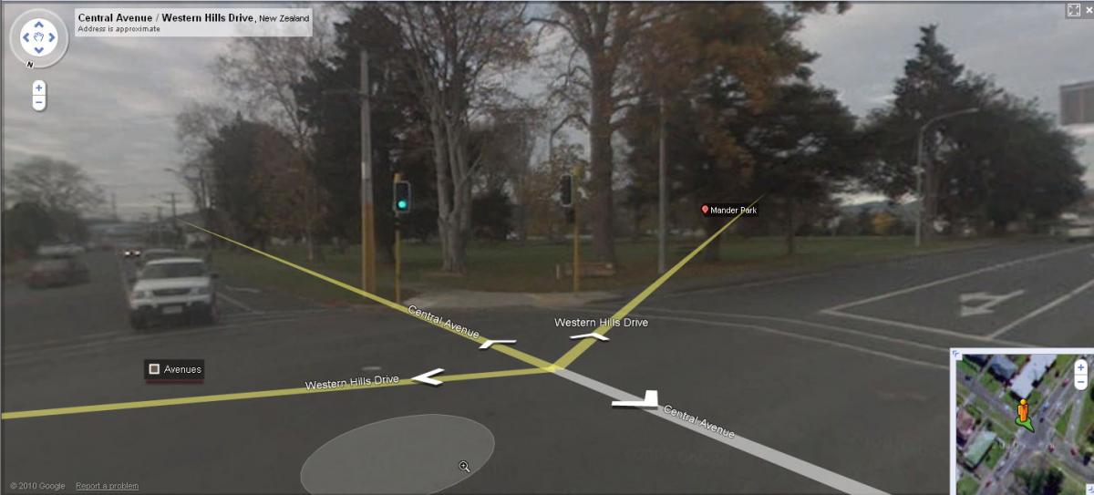
Figure 10 – Mander Park Looking South from intersection of SH1 and Central Ave.
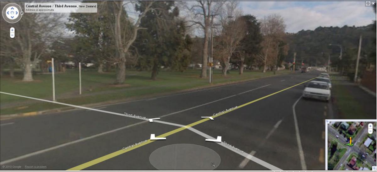
Figure 11 – Mander Park Looking west from Central Ave
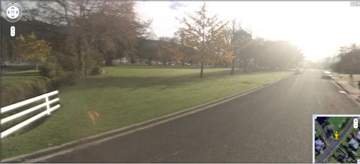
Figure 12 – Mander Park Looking North along Third Ave
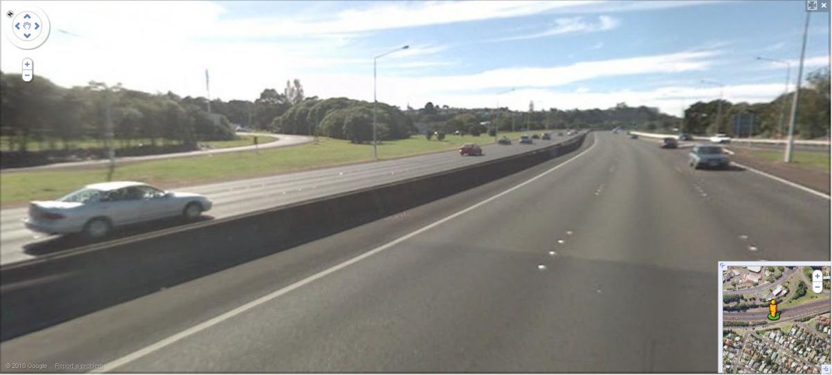
Figure 13 – State Highway 16 Looking East
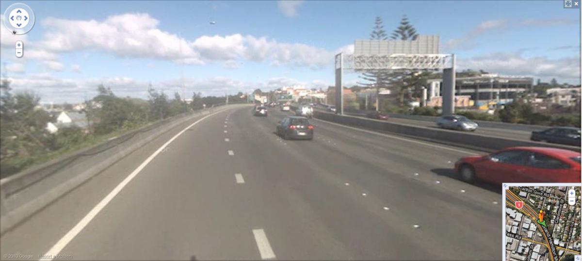
Figure 14 – State Highway One Looking South
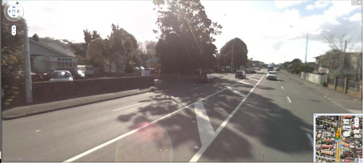
Figure 15 – Manuku Road Looking North
Summary
Even though I am asthmatic, I live in Whangarei for two main reasons:
1. The green areas.
2. The relaxing lifestyle.
By going through with these recommendations as stated from page 45 onwards, in the Hearing report, you are taking these two reasons away from me. You are destroying my heritage and my children’s future. The Visual amenity of these long life trees and beautiful peaceful park do outweigh the short-term benefits of a rushed design to fix a problem, which hasn’t been looked at thoroughly.
Widening the State Highway can be done without touching the trees and park, and the WDC handed NZTA $5 million two years ago to do just that. Therefore I reject the Proposed landscape concept plan, mitigation works, landscape drawings and proposed planting schedule that have been recommended in item 16 of the recommendations of the hearing report (page 48).
For a full copy of the submission Click Here!
Some pictures have been provided by Google Maps.